Plan Communal de Sauvegarde
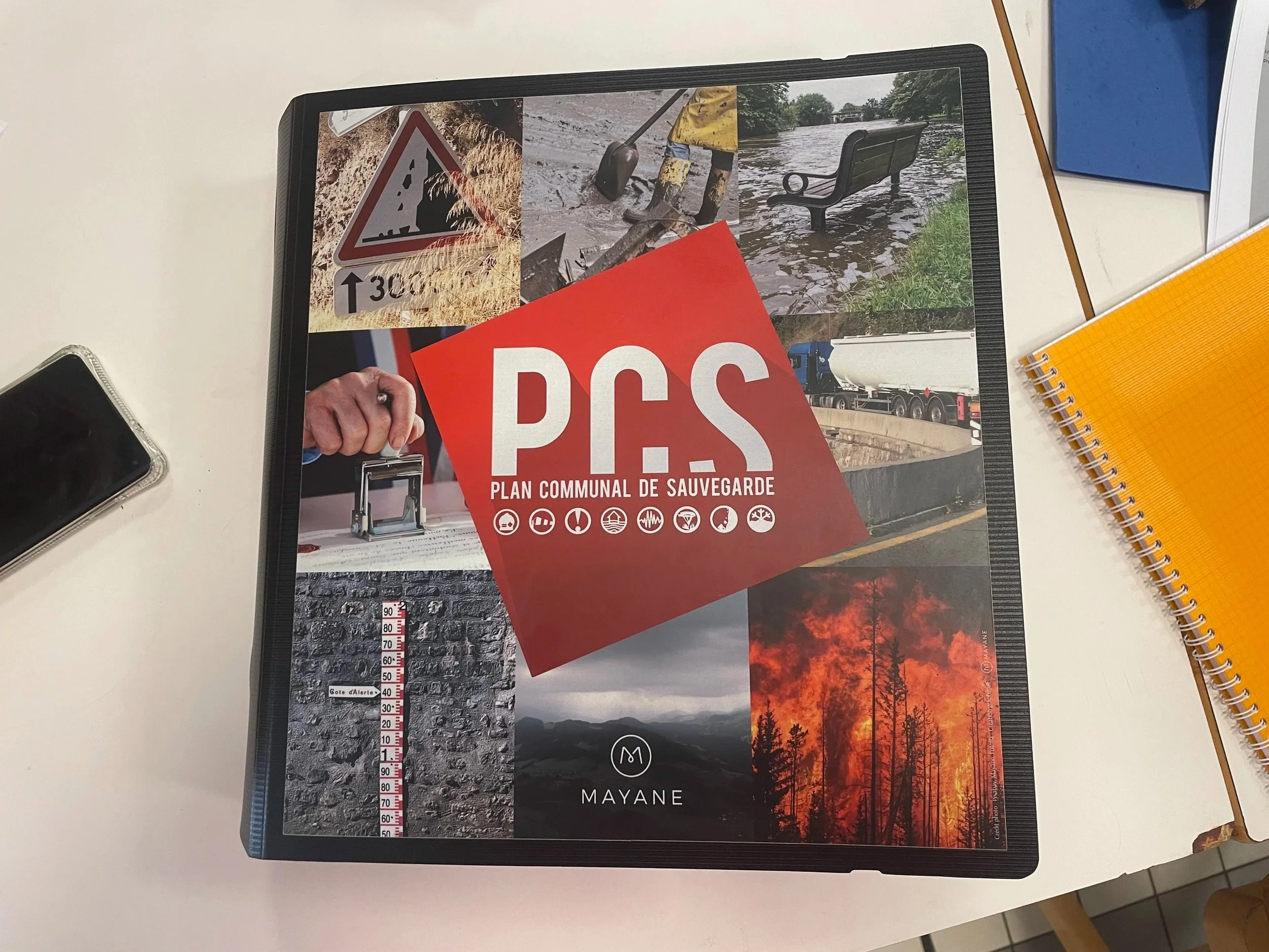
This is a book you do not want to have to use. It’s our village crisis plan. Our Plan Communal de Sauvegarde. Today was our training in how to use it - both for elected councillors and our Mairie (the town hall) staff.
The PCS contains a very comprehensive village-wide ‘what to do in case of emergency’ manual as well as some pretty interesting risk maps of the village including details of the flood zones. And the risks are not exactly where we’d have expected them.
Fuilla is a long village (technically a collection of small villages and hamlets) strung out along the length of a broad section of the Rotja valley. It follows the line of the river Rotja for a couple of kilometres and also includes a residential area at the foot of the valley where the Rotja converges with the Cady and the Tet. This part is disconnected from the rest of the village by over 2km. The Rotja runs along the length of the village - and is an obvious flood risk - particularly if debris gets caught by the bridge at the lower end of Fuilla. Rising water at the bridge would close the road that connects us to main road (the Route National) and the valley of the Tet, as well as inundating some homes in the strip along the watercourse. However there are also a couple of ravines on one side of our valley that can turn into gushing watercourses in extreme weather. The flood modelling shows that a sector of superficially safe-looking houses could quickly be surrounded by surface water in the event of extreme rainfall, and residents could be at risk.
Just looking at the maps and understanding this was both really useful - and quite salutary. Having spent 20 years living in a flood-prone valley in Yorkshire I have a lot of experience of the impact of extreme rainfall and now having actual responsibility in the case of disaster was pretty serious.
What was also useful was understanding the areas of responsibility within the French organisations which deal with emergencies and disasters. There are official risk level alerts which are declared nationally, regionally or locally and the disaster response can be declared at different levels. The trainer explained how a village like ours would be informed of risks and how we’d be expected to organise in case of crisis. Given the forested and mountainous area we live in, disasters could be anything from forest fires to extreme snowfall. A crisis need not directly affect our actual village to activate the plan - we could be called upon as a resource to help with events in neighbouring areas. A landslide closes the main road to Andorra and a bus load of tourists are stranded? A village uphill needs evacuating because of a fire risk? We could be asked to launch our action plan to assist.
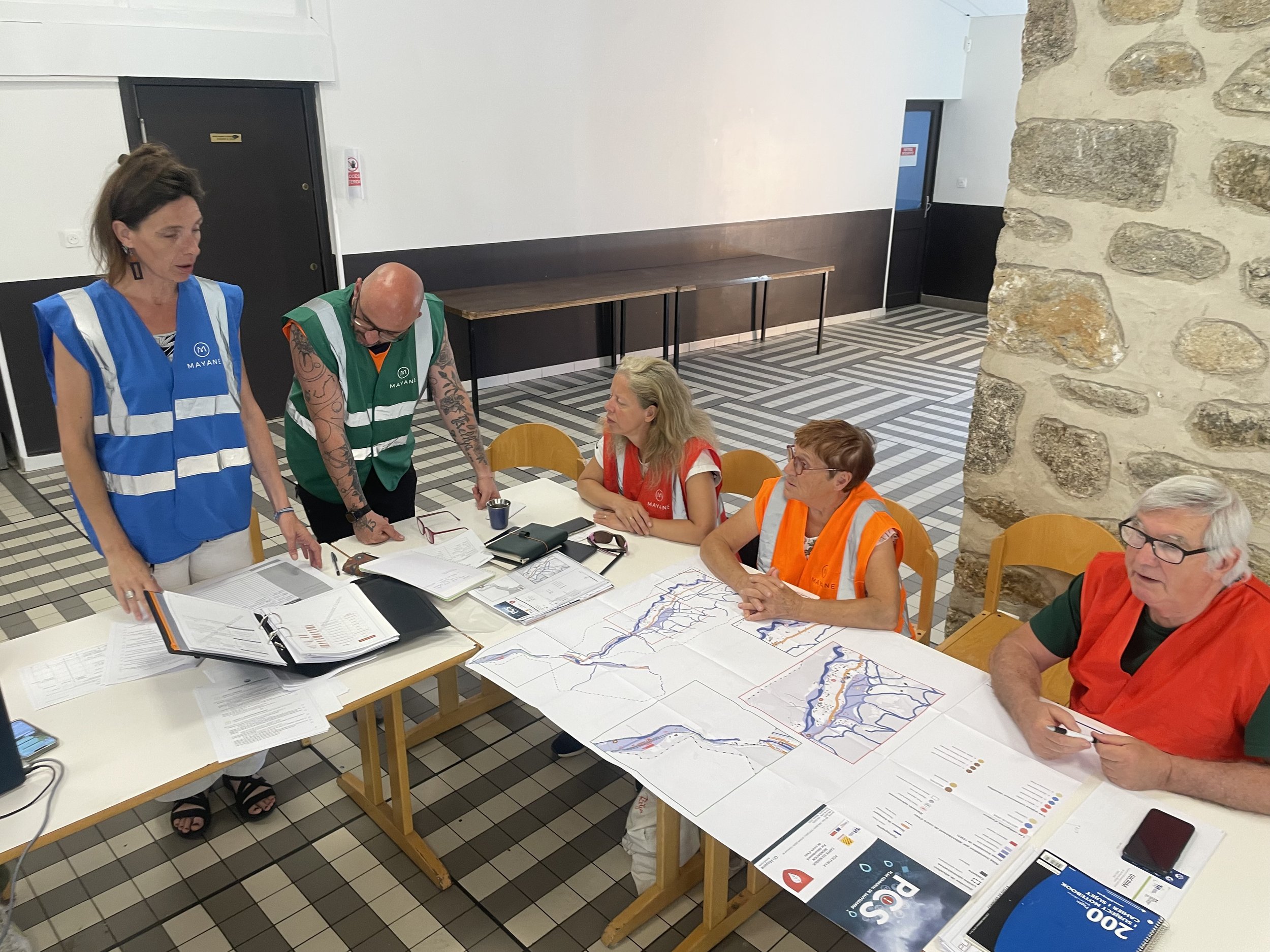
Scenarios mean tabards… the team in action
Just as we were familiarising ourselves with the possibilities (and bearing in mind I am operating in my third language so I’m a bit slower than my colleagues when it comes to digesting information) the trainer announced we’d be role playing an actual scenario compressing an emergency into 90 minutes.
The scenario unfolded from a yellow weather warning for heavy rain which - after days of rain - was raised to a red flood alert engendering a series of consequences which necessitated declaring a crisis and launching our plan. First of all came news that sixty five people were stranded by a landslide on the train track, of which only fifteen could be accommodated in a neighbouring village, so we opened the village hall accommodate them. Meanwhile the rain continued and the ravines became engorged with water which threatened a section of the village. We had to move to a plan to support the evacuation of several homes as the waters rose and flooding and consequent instability threatened people’s safety. Then by day three there were a couple of youths playing on scrambler bikes in the floodwater and a lady running out of medication whilst sheltering in place. It was quite high pressure even though just a simulation. We were all learning as we went about how to keep a proper account of the decisions we made, what and how to communicate with people (we have a village information app - Panneau Pocket - but not everyone reads it), with the regional authorities, and with the emergency services.
One of the excellent things is that Frédérique (the mayor’s secretary) is always prepared, and had already completed the preliminary work by surveying our village for vulnerable people and potential resources. The crisis plan manual already includes the lists of addresses and phone numbers of people who may need more help, and a full list of accommodation and resources we could call on. We have a sizeable village hall attached to a former outdoor centre which has 40 rooms of accommodation. Plus there are stocks of drinking water and other essentials kept on hand in the village depot, not to mention the village cafe which could be asked to help in a crisis. There are also a lot of willing volunteers in our village - which is one of the reasons it’s a great place to live. So we’re actually pretty well-resourced.
The training was about making sure we were aware of our responsibilities, prepared to used those resources well and were connected into the other resources and systems - the disaster response structures and the emergency services - in the region and at national level.
I definitely don’t want to have to use the Plan Communal de Sauvegarde - but I’m glad it’s there.